Just Drive. Part 1.

June 10, 2015

DAY ONE.

    With only a day to prepare, I left for a couple nights in Eastern Oregon with a friend.  We had no real goal in mind other than to get out of Portland by heading to the high desert and seeing wildlife. Not only the destination but even the travel route changed multiple times mid-trip.  The choice ultimately narrowed down to either the Fort Rock area or head further SE to Malhuer NWR and the Steen Mountains.  The preferred McKenzie Pass remained closed for a couple more weeks despite the mild winter so we drove through the Santiam route and afterwards passed the vicinity of some places I have been interested in like Lost Lake, Black Butte, 4-Mile Butte and Sunlight Cave. 
    
Willamette National Forest.  A couple of the Three Sisters and Mt Washington.

Willamette National Forest.  A small portion of the 90,769 acres of forest burned in the Central Cascade Range during The B&B Complex Fires in 2003.

A Columbine wildflower near Cold Springs outside Sisters, Oregon.

Eastern-eyed Click Beetle near Sister, Oregon.

    Deciding to first head SE towards the Steen Mountains and then drive to Fort Rock for the following night, we stopped in Riley for gas at a station with a small wall of free maps and brochures.  We looked through some maps and picked what looked like a 4WD road and asked each station employee if they had ever taken that road all the way east.  No one had.  Since we did not care so much about the destinations and mostly wanted to see wildlife, we chose to drive the dirt roads not caring if a fence or a dead-end eventually forced us to turn around.
   After a couple slow drive-bys and a few pullovers at various unlabeled dirt roads, we finally felt confident we found the correct road we wanted.  Within the first few miles we encountered the first of various groups of grazing cows blocking our route.  Calves quickly ran from the vehicle. The older ones slowly walked to the side.  A few stared as we passed.  All eat the landscape dead.
 
Traffic on the road that took us towards the Steen Mountains and past that mountain poking up from the horizon on the right.  

Approaching the mountain while losing the road.


Jeff getting closer to try and photograph a Golden Eagle perched on top of the ridge.

The cliffs we hiked through the sagebrush to so we could check out some nesting Common Ravens and look for American Badgers and Western Rattlesnakes. We did not find any badgers or snakes.  However we repeatedly saw Pronghorn Antelope.

Townsend Ground Squirrel.  Picture through binoculars.
  
Loggerhead Shrike.  Not pictured but also seen: Ferruginous Hawks, Horned Larks, Warbling Vireos, Dark-eyed Junkos, a Yellow-headed Blackbird, Forster's Terns, Kangaroo Rats, a Yellow-bellied Marmot and Pygmy short-horned lizards amongst other animals I am forgetting.  Picture through binoculars.

As the sun began descending, the ground turned into a dry lake bed.  We debated just camping on the road amid all the jackrabbits, squirrels and curlews.

Rolling up on the mountain.  We stopped here to take pictures of some jackrabbits, look at a giant half-buried bone (probably a cow's) and briefly watch some Long-billed Curlews.

A very casual Black-tailed Jackrabbit stretching before the sun goes down.
Picture through binoculars.

Continuing East, we left the mountain behind us, opened up and passed through one last cattle gate to finally enter into the Malhuer NWR area.  We stopped one last time to enjoy the sunset.  From here the drive primarily consisted of avoiding the numerous jackrabbits darting before the truck or the scattering Common Nighthawks trying to roost in the road.


Bald Butte

Mt. Hood National Forest, OR.
May 31, 2015


    With my legs still sore from a couple hikes with 1,000' elevation gains within a mile or so I have no idea why I decided to do the Bald Butte hike.
    Maybe because it was short?  It's less than a mile to an elevation of around 7,500'.
    Maybe cause the drive's last half mile is on a high clearance road?  I always like driving dirt roads.  Basically you follow the power-lines up the butte and park under them when the road ends.
    Maybe for the wildflowers?  This time of year the hike's perpetual view of Mt Hood from up-close is continually accented with blue Lupine, red Paintbrush and yellow Balsamroot.  The beauty of a Dog Mountain hike for way less effort, no day-use fees and most importantly no crowds.

My cellphone repeatedly hates to focus on wildflowers.

   At the start of the hike the power-lines are right above you with Mt Hood in the background.  There were a group of turkey vultures circling nearby further up so I hiked off-trail towards them.  When I got closer and with the steepness of the hill they were sometimes soaring only 30 ft above me.


Looking south back down at part of the steep hike up.  You can not tell from this cellphone picture but the hillside is covered in wildflowers.

  There was a great payoff for such a short hike.  At the top in a single spot you can see the Cascade Range from Mt St. Helens to Mt Adams to Mt Rainier to Mt Hood.

Mt St. Helens from atop Bald Butte.

    The trail continues around the butte but offers no more special views.  There also were some trails that went down through the woods that I did not venture too far into. Instead, I ate some snacks on the hillside and headed back to my truck.

Cake the Truck at the end of the road.  There is a mountain bike trail that starts here as well.


Beans The Cat


Beans helping me explore hikes on Mt. Hood.

Beans reminding us all to "Hang in there."

Beans just being himself.

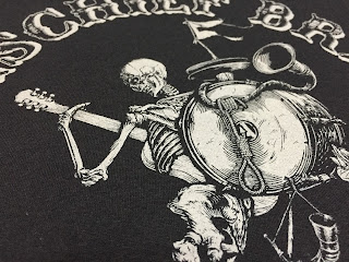
Mischief Brew


Discharge light grey for old East Coast friends.


Discharge White Ink tour shirts.

Eberhardt Press


Charles cleaning up the Kluge so he can use it as a die cutter.

Trout Lake Ice Caves

Gifford Pinchot National Forest. WA.
May 24, 2015

The Trout Lake Ice Cave is really a lava tube formed from a pahoehoe basaltic lava flow dating possibly as far back as to the late Pleistocene era.  Originally known to pioneers as the Guler Ice Cave, it supplied ice for the towns of Hood River and The Dalles. Mostly for the taverns I am sure.  A sign declares it has been known about for almost a hundred years but I am a pretty sure the local indigenous tribes knew about it way longer than a hundred years ago as they were the ones who originally showed the pioneers the cave along with how to find and access it. Today, for better or worse, you can drive right up to the entrance.
  Before making it into Indian Heaven territory, we stopped to check out a male peacock in full display for a group of females at the old abandoned school, I think it was on 141?  I did not get any decent pictures that could survive being viewed on a monitor but outside the caves this deer was casually and calmly cleaning up after some sloppy campers.
View out from inside the main cave. There are other smaller caves which a few of them can actually be accessed from each other if you climb through the right spots.


There was not much ice this year. Since it is formed by the accumulated snow on the upper ground melting through and dripping into the cave below. With our mild winter this year there was not much snow accumulation.  When I visited last year mid-summer even it had more ice then.

Back home in Portland.

    Despite there not being much ice it was really just a pit stop on a loop drive on dirt roads. On an extremely pothole ridden dirt road around the Big Lava Flow a young barred owl almost flew into the car through the driver's side window.  Although I quickly got out and visually followed it to its new perch deeper in the woods, it did not sit long enough to take a crappy cellphone picture through binoculars.


Beans The Cat


Beans as I am leaving for work in the morning.


Beans greeting me after returning from work.

Chris Jacobson Tattoo